Geokuup Metadata Catalogue
Recommended riparian buffer strip width
Soovituslik kaldavööndi puhverriba laius
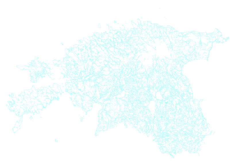
Recommended riparian buffer strip widths for natural water bodies and drainage ditches in Estonia, calculated based on soil and terrain characteristics to estimate how wide the buffer strip should ideally be if agricultural land is located adjacent to the water body (Uuemaa et al. 2026). Buffer strips were calculated for all water bodies subject to water protection zone requirements; however, where no agricultural land is present near the water body, a buffer strip may not be necessary.
Attributes
Name: stream name for which the buffer applies
ehitise_ko: drainage system construction code
ehitise_ni: drainage system construction name
ms_kood: drainage system code
References:
Uuemaa, K., Kmoch, A., Kull, A., Mõisja, K., Tominga, H.I., Mander, Ü., 2026. National-scale geospatial modelling of recommended riparian buffer widths. Ecological Engineering.
Soovituslik kaldavööndite puhverribade laius Eesti looduslikele veekogudele ja maaparanduskraavidele, mis on arvutatud mullastiku ja reljeefiomadustest lähtuvalt kui lai võiks soovituslikult puhverriba olla juhul kui veekogu ääres on põllumaa (Uuemaa et al. 2026). Puhverribad on arvutatud kõikide veekaitsevööndi kohustusega veekogude äärde, aga kui seal põllumaad ei ole, siis ei pruugi puhverriba üldse vajalik olla.
Atribuudid
Name: veekogu nimi
ehitise_ko: maaparandussüsteemi ehitise kood
ehitise_ni: maaparandussüsteemi ehitise nimi
ms_kood: maaparandussüsteemi kood
Viited:
Uuemaa, K., Kmoch, A., Kull, A., Mõisja, K., Tominga, H.I., Mander, Ü., 2026. National-scale geospatial modelling of recommended riparian buffer widths. Ecological Engineering.
Simple
-
Date (Publication)Date (Publication)
- 2026-05-04
-
StatusStatus
-
CompletedCompleted
- Point of contact
-
Organisation name Individual name Electronic mail address Role Landscape Geoinformatics Lab, Univesrity of Tartu
Maastikugeoinformaatika töörühm, Tartu Ülikool
Evelyn Uuema
Evelyn Uuemaa
Principal investigatorPrincipal investigator
-
Maintenance and update frequencyMaintenance and update frequency
-
As neededAs needed
-
ThemeTheme
-
-
PlacePlace
-
-
World
-
-
Access constraintsAccess constraints
-
LicenseLicense
-
Use constraintsUse constraints
-
otherRestictionsotherRestictions
-
Other constraintsOther constraints
-
License CC-BY 4.0 ( https://creativecommons.org/licenses/by/4.0/).
Please cite:
Uuemaa, K., Kmoch, A., Kull, A., Mõisja, K., Tominga, H.I., Mander, Ü., 2026. National-scale geospatial modelling of recommended riparian buffer widths. Ecological Engineering.
Litsents CC-BY 4.0 ( https://creativecommons.org/licenses/by/4.0/).
Palun viidata:
Uuemaa, K., Kmoch, A., Kull, A., Mõisja, K., Tominga, H.I., Mander, Ü., 2026. National-scale geospatial modelling of recommended riparian buffer widths. Ecological Engineering.
-
Spatial representation typeSpatial representation type
-
VectorVector
-
DenominatorDenominator
- 10000
-
LanguageLanguage
- English
-
Character setCharacter set
-
UTF8UTF8
-
Topic categoryTopic category
-
-
Inland watersInland waters
-
- Begin date
- 2025-01-01
- End date
- 2025-12-31
))
-
Reference system identifierReference system identifier
-
L-EST97 (EPSG:3301)L-EST97 (EPSG:3301)
- Distribution format
-
Name Version
- OnLine resource
-
Protocol Linkage Name OGC:WMS
https://maps.landscape-geoinformatics.org/geoserver/veemajandus/wms soovituslik_puhverriba_geomeetria
-
Hierarchy levelHierarchy level
-
DatasetDataset
-
StatementStatement
-
The recommended riparian buffer strip width dataset was generated using a national-scale geospatial modelling workflow implemented in Python and QGIS, based on the empirical nomograph of Mander and Kuusemets (1998). Input data included a 5 m digital elevation model (Estonian Land and Development Board, 2025), EstSoil-EH soil dataset, natural water bodies, and drainage ditch datasets for Estonia. Slope, flow accumulation, flow length, and LS-factor were derived from the elevation model and combined into a composite specific slope length index. Soil texture classes were reclassified according to the nomograph requirements. Estonia was processed in 22 overlapping zones with 5 km buffers to preserve hydrological continuity and minimise edge effects. The resulting raster of recommended buffer widths was vectorised along water bodies into 5 m segments and then dissolved into one continuous buffer.
Estonian Land and Spatial Development Board, 2025. Elevation Data. URL: https://geoportaal.maaamet.ee/eng/spatial-data/elevation-data-p308.html (October 2025).
Kmoch, A., Kanal, A., Astover, A., Kull, A., Virro, H., Helm, A., Pärtel, M., Ostonen, I., and Uuemaa, E., 2021. EstSoil-EH: a high-resolution eco-hydrological modelling parameters dataset for Estonia. Earth Syst. Sci. Data, 13, 83–97, https://doi.org/10.5194/essd-13-83-2021.
Mander, Ü., Kuusemets, V., 1998. Mander, Ü. and Kuusemets, V. 1998. Non-point pollution control by riparian buffer strips: Dimensioning and efficiency assessment., in: Proceedings of the 3rd International Conference on Diffuse Pollution. Edinburgh, pp. 136–143
Uuemaa, K., Kmoch, A., Kull, A., Mõisja, K., Tominga, H.I., Mander, Ü., 2026. National-scale geospatial modelling of recommended riparian buffer widths. Ecological Engineering.
Uuemaa et al. (2026) välja töötatud soovituslike veekogude puhverribade soovituslike laiuste andmestik loodi üleriigilise ruumilise modelleerimise töövoo abil, mis rakendati Pythonis ja QGIS-is ning põhines Manderi ja Kuusemetsa (1998) empiirilisel nomogrammil. Sisendandmetena kasutati Eesti 5 m kõrgusmudelit (Eesti Maa-ja Ruumiamet, 2025), EstSoil-EH (Kmoch et al. 2021) mullastikuandmestikku, looduslike veekogude ning maaparandussüsteemide eesvoolude andmestikke. Kõrgusmudeli põhjal arvutati nõlvakalle, vooluakumulatsioon, voolutee pikkus ja LS-faktor, mis ühendati nõlva pikkuse koondindeksiks. Mullalõimise klassid klassifitseeriti ümber vastavalt nomogrammi nõuetele. Tulemuseks saadud soovituslike puhverribade laiuste raster teisendati vektoriks ja jagati veekogude ääres 5 m lõikudeks, kuhu loeti rastrist külge soovituslik laius ning seejärel ühendati üheks pidevaks puhveralaks.
Eesti Maa-ja Ruumiamet, 2025. Kõrgusmudelid. URL: https://geoportaal.maaamet.ee/est/ruumiandmed/korgusandmed/korgusmudelid-p508.html (October 2025).
Kmoch, A., Kanal, A., Astover, A., Kull, A., Virro, H., Helm, A., Pärtel, M., Ostonen, I., and Uuemaa, E., 2021. EstSoil-EH: a high-resolution eco-hydrological modelling parameters dataset for Estonia. Earth Syst. Sci. Data, 13, 83–97, https://doi.org/10.5194/essd-13-83-2021.
Mander, Ü., Kuusemets, V., 1998. Mander, Ü. and Kuusemets, V. 1998. Non-point pollution control by riparian buffer strips: Dimensioning and efficiency assessment., in: Proceedings of the 3rd International Conference on Diffuse Pollution. Edinburgh, pp. 136–143
Uuemaa, K., Kmoch, A., Kull, A., Mõisja, K., Tominga, H.I., Mander, Ü., 2026. National-scale geospatial modelling of recommended riparian buffer widths. Ecological Engineering.
Metadata
-
File identifierFile identifier
- ba333a33-88a6-453f-b2bb-e5c1ac121527 XML
-
Metadata languageMetadata language
- English
-
Character setCharacter set
-
UTF8UTF8
-
Date stampDate stamp
- 2026-05-24T15:07:01.933Z
- Metadata standard name
-
ISO 19115:2003/19139
- Metadata standard version
-
1.0
- Metadata author
-
Organisation name Individual name Electronic mail address Role Landscape Geoinformatics Lab, University of Tartu
Maastikugeoinformaatika töörühm, Tartu Ülikool
Evelyn Uuemaa
Evelyn Uuemaa
Point of contactPoint of contact
- Other language
-
Language Character encoding EE EestiEstonianUTF8UTF8EE EnglishEnglishUTF8UTF8